Drives Through a Point
 Vizzion's "Drives Through a Point" sample application
Vizzion's "Drives Through a Point" sample application illustrates a number of considerations when developing an application that attempts to retrieve Drives that pass through a specific location. For more general information on retrieving Drives and Drive streams, refer to the Drives sample.
Finding Drives in the Vicinity of a Location
Drives can vary in length from a few seconds to 60 seconds or more. A 60 second Drive can cover more than 1km, so this sample looks for any Drives within a 1km (approx.) box around the target location. The previous 7 days are searched, and offline Drives are discarded.
Identifying Drives that May Pass Through a Location
The API returns only the start and end location of a Drive. This sample shows how to create a straight line from the start point to the end point of each Drive, and then determine how close the line passes to the desired location. Depending on the exact route driven by a vehicle, this technique may not catch all Drives that pass through the desired location, and may include some Drives that do not pass through the desired location, but this is a reasonably effective and simple way to find candidate Drives.
Finding Images of a Location
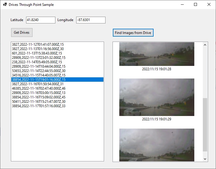
Once a candidate Drive is identified, the Drive stream can be retrieved and individual image locations examined to see if any are close enough to the desired location. This sample shows how to download a selected stream, extract the latitude and longitude from the EXIF data in the images, and display any images that are near to the desired location.
Downloads
| Download | Details |
|---|---|
| Source code | Requires Visual Studio 2012 or later |